Late Cold during Winters in Washington State
March, 2018
As reported above, the last 2 weeks of February were quite chilly, with numerous locations setting all-time lows for the date on the 23rd. Many places have had their coldest temperatures of this winter in late February, even though the nights are noticeably shorter than in December and January. We were curious about how often this sort of thing happens based on the historical record, with an arbitrary start of the winter of 1949-1950. Our procedure was to simply catalog the instances when February (or in a couple of cases, March) included the coldest minimum temperature of the winter. This was done for 4 stations on the west side of the state (Forks, Vancouver, Olympia, and Bellingham) and 4 stations on the east side (Tri-Cities, Winthrop, Pullman, and Spokane Airport).

Out of the 69 years considered, the number of winters with February or March having the lowest or tied for the lowest daily minimum temperature ranged from 14 at Forks and Vancouver to 6 at Winthrop and Pullman (Table 1). Olympia and Bellingham have had one winter during which the lowest minimum temperature was recorded in March; Vancouver has had two winters with the lowest temperatures that late in the season.
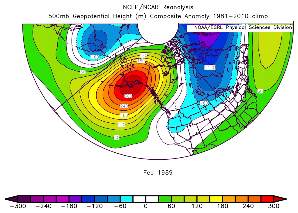
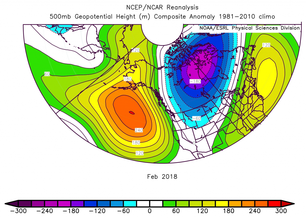
It turns out that February 2018 was a rather unusual from the perspective that each of the 8 stations considered had their coldest temperatures of the season during that month. Here it is assumed that March of 2018 will lack any extreme cold snaps (at least there is no indication of the sort in the numerical weather prediction forecasts at the time of this writing). There is only one other example in the record going back to 1950 for which essentially the entire state experienced its coldest temperatures in February, and that is the year of 1989. By many measures, February 1989 was extraordinary. An extreme Arctic air outbreak occurred early in the month with widespread records set for the month, followed by another period of unusually cold weather near the end of the month extending into March, accompanied by substantial lowland snow.


The large-scale atmospheric circulation anomalies for February 1989 and 2018 resemble one another, as illustrated by the 500 hPa geopotential height anomaly distributions of Figures 1a and 1b. It bears emphasizing that the February of 1989 was much colder than that of 2018 in terms of both the monthly mean and lowest daily minimum temperatures. The easterly component to the anomalous flow shown in Figure 1a implies that
much more of a continental source for the air mass during 1989.
Both 1989 and 2018 can be categorized as La Niña winters. It is generally appreciated that ENSO has its most robust impacts on the Pac NW during the late winter and the statistic considered here is no exception. Table 1 shows how many of the winters with the coldest temperatures in February or March coincide with La Niña (and El Niño). A disproportionate number of the winters with late cold have occurred with La Niña, and very few have occurred with El Niño. The moral of the story: while it might have seem farfetched given how warm it was in January of 2018, don’t give up on getting a real taste of winter during La Niña.
